Free Camp Guide

Free camping in Idaho

177 places on public land — 115 set campsites and 62 open areas you can camp anywhere within. 118 are confirmed free.

Idaho is really two places with one name. The north is forest. Tall timber, steep hillsides, and a river at the bottom of almost every valley. The Nez Perce-Clearwater, the Payette and the Salmon-Challis cover most of it. Drive south and the trees stop. What follows is open desert: sagebrush, low cliffs of dark rock, and the wide flat light of the Owyhee country. The two halves feel nothing like each other. Decide which one you want before you set off.

This is the emptiest state on the site. From most campsites here it is an hour or more of driving to reach a town with fuel and a shop. Some are a great deal further. That matters the day you get a flat tire. It is also why the night sky is so good. There are no towns close enough to spoil it. Many of these places sit above 5,000 feet, and a few are near 10,000. Snow closes those roads until late spring, so the season is shorter than you might expect.

Bring everything you need. Almost none of the Idaho sites has drinking water, and none of the ones we can check has a toilet. Carry your water in, and carry everything else out. People come here to walk, to watch animals and to fish. Plenty of the sites sit on water big enough for a boat.
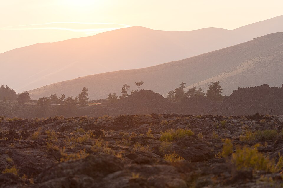
Sunset over the black lava flows at Craters of the Moon, Idaho
Craters of the MoonNational Park Service

Going to see something famous?

Idaho’s best known sights sit in the south of the state. Craters of the Moon is a wide field of black lava you can walk out onto. Borah Peak is the highest mountain in Idaho. Both have free camping within reach. Idaho has no national park of its own. Grand Teton is over the border in Wyoming, and the nearest place on this page is more than 80 miles from it.

Important Note: Distances are along the road and rounded. Each landmark is pinned to a single point on the map. With a big park that point sits somewhere in the middle of it, so the entrance you actually drive to could be a fair bit closer than the number here.

Where in Idaho?

Pick a town to see only the places near it. They are grouped by the nearest town that has fuel and a shop, because that is the thing you plan a trip around. Places marked open area are public land where you can camp anywhere inside the boundary, and there are 62 of them here. There is no one set spot to aim for.

Narrow it down

Grangeville 31

Closest town with fuel and a shop, about 3,627 people. These places are 19 to 87 road miles from it, closest first.

Free to camp Meadow Creek Campground 19 miles to Grangeville · 2,395 ft above sea level · 28 miles to Tolo Lake Meadow Creek Campground is located along the South Fork of the Clearwater River. The campground has 3 units with picnic tables and toilets. Partly free to camp Lower Salmon River 23 miles to Grangeville 1,407 ft above sea level Camping fee unknown Snowhole Rapids Wilderness Study Area 29 miles to Grangeville 1,314 ft above sea level · open area Free to camp Rocky Bluff Campground 33 miles to Grangeville 5,591 ft above sea level · rough road Free to camp North Fork Slate Creek Campground 35 miles to Grangeville 3,655 ft above sea level · rough road Free to camp Leggett Creek Campground 37 miles to Grangeville 3,884 ft above sea level Free to camp Oxbow Campsite 41 miles to Grangeville 3,837 ft above sea level · rough road Free to camp Sing Lee Campground 44 miles to Grangeville 4,088 ft above sea level · rough road Free to camp Iron Phone Junction Campground 45 miles to Grangeville 5,535 ft above sea level · rough road Free to camp Crooked River Campground #3 47 miles to Grangeville 3,955 ft above sea level · rough road Free to camp Ten Mile 47 miles to Grangeville 4,000 ft above sea level · rough road Free to camp Table Meadows Campground 49 miles to Grangeville 4,704 ft above sea level Free to camp O'Hara Saddle Campground 54 miles to Grangeville 5,231 ft above sea level · rough road Free to camp Five Mile Campground 55 miles to Grangeville 4,830 ft above sea level · rough road Free to camp French Gulch Campground 56 miles to Grangeville 4,191 ft above sea level · rough road Free to camp Orogrande Campground #1 and #2 56 miles to Grangeville 5,156 ft above sea level · rough road Free to camp Orogrande Campground #3 and #4 56 miles to Grangeville 5,156 ft above sea level · rough road Free to camp Cold Springs Trailhead 60 miles to Grangeville 6,616 ft above sea level · rough road · no water Free to camp Orogrande Summit Campground 63 miles to Grangeville 7,620 ft above sea level · rough road Free to camp Limber Luke Campground and Trailhead 64 miles to Grangeville 5,364 ft above sea level Free to camp Wildhorse Campground 65 miles to Grangeville 7,541 ft above sea level · rough road Free to camp Trapper Creek Camp Area 65 miles to Grangeville 4,660 ft above sea level · rough road Free to camp Ditch Creek Campground 66 miles to Grangeville 4,889 ft above sea level · rough road Free to camp Nez Perce National Historic Trail 69 miles to Grangeville 1,202 ft above sea level · open area Free to camp Bridge Creek Campground 72 miles to Grangeville 5,024 ft above sea level Free to camp Mallard Creek Campground 76 miles to Grangeville 5,072 ft above sea level Free to camp Sam's Creek Campground 81 miles to Grangeville 5,774 ft above sea level · rough road Free to camp Granite Springs Campground 84 miles to Grangeville 5,905 ft above sea level Free to camp Dixie Meadow Campground 84 miles to Grangeville 5,125 ft above sea level · rough road Free to camp Halfway House Campground 84 miles to Grangeville 5,644 ft above sea level · rough road Free to camp Poet Creek Campground 87 miles to Grangeville 4,974 ft above sea level · rough road

McCall 18

Closest town with fuel and a shop, about 4,104 people. These places are 11 to 195 road miles from it, closest first.

Free to camp Brundage Reservoir Dam Day Use Site 12 miles to McCall · 6,213 ft above sea level · 16 miles to Payette Lake · rough road in Located at the outlet of Brundage Reservoir is a small day use site. The site includes a picnic table and toilet. Fishing is great at the reservoir so bring your fishing pole. Camping fee unknown Box Creek Wilderness Study Area 11 miles to McCall 5,889 ft above sea level · open area Free to camp Goose Lake Camping Area 16 miles to McCall 6,387 ft above sea level Free to camp 33 Lake Camping Area 18 miles to McCall 6,507 ft above sea level Free to camp Upper Payette Lake Camping Area 18 miles to McCall 5,571 ft above sea level · rough road Free to camp Granite Lake Camping Area 19 miles to McCall 6,763 ft above sea level · rough road Free to camp Paddy Flat Camping Area 19 miles to McCall 5,305 ft above sea level · rough road Free to camp Rapid Creek Camping Area 21 miles to McCall 5,558 ft above sea level · rough road Free to camp Lost Valley Reservoir Camping Area 26 miles to McCall 4,818 ft above sea level · rough road Free to camp Smokey Boulder Camping Area 31 miles to McCall 4,715 ft above sea level · rough road Free to camp Lake Creek Camping Area 33 miles to McCall 6,286 ft above sea level · rough road Free to camp Indian Point Camping Area 36 miles to McCall 3,712 ft above sea level Free to camp Deadman Bar Camping Area 41 miles to McCall 3,976 ft above sea level Camping fee unknown Marshall Mountain Wilderness Study Area 47 miles to McCall 6,044 ft above sea level · open area Free to camp Old East Fork Camping Area 50 miles to McCall 4,683 ft above sea level · rough road Free to camp Shiefer Campground 65 miles to McCall 2,951 ft above sea level · rough road Free to camp Chamberlain Basin Camping Area 86 miles to McCall 5,637 ft above sea level Free to camp Mackay Bar Campground 195 miles to McCall 2,247 ft above sea level · rough road

Owyhee 17

Closest town with fuel and a shop, about 1,027 people. These places are 38 to 374 road miles from it, closest first.

Free to camp Owyhee Wild and Scenic River 38 miles to Owyhee · 4,729 ft above sea level · 55 miles to Porter Peak · rough road in · camp anywhere inside it The Owyhee River canyon consists of a steep, rhyolite walls ranging in height from 250 feet to over 1000 feet near the Oregon border. Free to camp South Fork Owyhee Wild and Scenic River 38 miles to Owyhee 4,734 ft above sea level · rough road · open area Free to camp Bruneau-Jarbidge Rivers Wilderness Area 58 miles to Owyhee 4,195 ft above sea level · open area Camping fee unknown Bruneau Wild and Scenic River 58 miles to Owyhee 3,694 ft above sea level · rough road · open area Free to camp Cottonwood Creek Wild and Scenic River 68 miles to Owyhee 5,121 ft above sea level · rough road · open area Free to camp Duncan Creek Wild and Scenic River 72 miles to Owyhee 5,673 ft above sea level · rough road · open area Camping fee unknown Jarbidge Wild and Scenic River 76 miles to Owyhee 4,978 ft above sea level · open area Free to camp West Fork Bruneau Wild and Scenic River 76 miles to Owyhee 5,488 ft above sea level · open area Camping fee unknown Jarbidge River Launch Site 77 miles to Owyhee 5,372 ft above sea level Free to camp Battle Creek Wild and Scenic River 84 miles to Owyhee 5,319 ft above sea level · rough road · open area Free to camp Pole Creek Wilderness Area 121 miles to Owyhee 5,613 ft above sea level · open area Camping fee unknown North Fork Owyhee Wilderness Area 130 miles to Owyhee 5,874 ft above sea level · rough road · open area Camping fee unknown North Fork Owyhee River 151 miles to Owyhee 4,837 ft above sea level · rough road Free to camp Dickshooter Creek Wild and Scenic River 152 miles to Owyhee 4,981 ft above sea level · rough road · open area Free to camp Deep Creek Wild and Scenic River 154 miles to Owyhee 4,676 ft above sea level · open area Camping fee unknown Owyhee River Wilderness Area 154 miles to Owyhee 5,214 ft above sea level · open area Free to camp Red Canyon Wild and Scenic River 374 miles to Owyhee 4,720 ft above sea level · open area

Salmon 16

Closest town with fuel and a shop, about 3,257 people. These places are 16 to 144 road miles from it, closest first.

Free to camp Cougar Point Campground 16 miles to Salmon · 6,595 ft above sea level · 79 miles to Big Hole National Battlefield 6600-foot elevation. 18 campsites in the Salmon River Mountains. Big game hunting in season. Short trails run north, south and west from the campground. Free to camp Goldbug Hot Springs 23 miles to Salmon 4,417 ft above sea level Free to camp Bear Valley Horse Camp 40 miles to Salmon 6,820 ft above sea level · rough road Free to camp Bear Valley Trailhead/Upper Campground 40 miles to Salmon 6,820 ft above sea level · rough road Free to camp Salmon River 41 miles to Salmon 4,637 ft above sea level · rough road Camping fee unknown Smokey Cubs Recreation Site 50 miles to Salmon 6,268 ft above sea level Free to camp Morgan Creek Recreation Site 55 miles to Salmon 5,562 ft above sea level · rough road Free to camp Morse Creek Campground 58 miles to Salmon 6,251 ft above sea level · rough road Free to camp Big Eightmile Campground/Trailhead 60 miles to Salmon 7,539 ft above sea level · rough road Free to camp Little West Fork Morgan Creek Trailhead 64 miles to Salmon 7,573 ft above sea level · rough road Free to camp Mosquito Flat Reservoir Campground 70 miles to Salmon 6,960 ft above sea level · rough road Free to camp Twin Peaks Camping Area 71 miles to Salmon 8,989 ft above sea level · rough road Camping fee unknown Goldburg Wilderness Study Area 74 miles to Salmon 7,816 ft above sea level · rough road · open area Free to camp Big Creek Campground 75 miles to Salmon 6,537 ft above sea level · rough road Free to camp Tin Cup Campground 136 miles to Salmon 5,433 ft above sea level · rough road Free to camp Indian Springs Campsite 144 miles to Salmon 7,568 ft above sea level · rough road

Bellevue 8

Closest town with fuel and a shop, about 2,582 people. These places are 28 to 73 road miles from it, closest first.

Kamiah 7

Closest town with fuel and a shop, about 1,163 people. These places are 37 to 77 road miles from it, closest first.

Gooding 6

Closest town with fuel and a shop, about 3,825 people. These places are 16 to 34 road miles from it, closest first.

Ketchum 6

Closest town with fuel and a shop, about 3,609 people. These places are 49 to 91 road miles from it, closest first.

Mountain Home 6

Closest town with fuel and a shop, about 16,912 people. These places are 42 to 52 road miles from it, closest first.

Joseph 5

Closest town with fuel and a shop, about 1,175 people. These places are 50 to 82 road miles from it, closest first.

Weiser 5

Closest town with fuel and a shop, about 6,112 people. These places are 23 to 55 road miles from it, closest first.

Aberdeen 4

Closest town with fuel and a shop, about 1,856 people. These places are 37 to 147 road miles from it, closest first.

Dillon 4

Closest town with fuel and a shop, about 4,242 people. These places are 72 to 92 road miles from it, closest first.

Shoshone 4

Closest town with fuel and a shop, about 1,757 people. These places are 5 to 40 road miles from it, closest first.

American Falls 3

Closest town with fuel and a shop, about 4,863 people. These places are 9 to 75 road miles from it, closest first.

Hamilton 3

Closest town with fuel and a shop, about 5,383 people. These places are 45 to 99 road miles from it, closest first.

Sun Valley 3

Closest town with fuel and a shop, about 1,771 people. These places are 43 to 118 road miles from it, closest first.

Buhl 2

Closest town with fuel and a shop, about 4,761 people. These places are 17 to 52 road miles from it, closest first.

Dover 2

Closest town with fuel and a shop, about 1,137 people. These places are 23 to 55 road miles from it, closest first.

Moreland 2

Closest town with fuel and a shop, about 1,264 people. These places are 22 to 73 road miles from it, closest first.

Osburn 2

Closest town with fuel and a shop, about 1,678 people. These places are 65 to 106 road miles from it, closest first.

Soda Springs 2

Closest town with fuel and a shop, about 3,162 people. These places are 23 to 28 road miles from it, closest first.

St. Maries 2

Closest town with fuel and a shop, about 2,487 people. These places are 22 to 34 road miles from it, closest first.

Elsewhere in Idaho 19

Each of these is on its own. No other free camping we know of shares its nearest town.

Free to camp Cedars Campground 80 miles to Frenchtown · 3,650 ft above sea level · 83 miles to Ch-paa-qn Peak · rough road in Cedars campground has five developed campsites situated alongside the North Fork of the Clearwater River and Long Creek. Partly free to camp California National Historic Trail | Idaho 31 miles to Rupert 4,315 ft above sea level · open area Partly free to camp Coeur d'Alene Lake 6 miles to Coeur d'Alene 2,147 ft above sea level Camping fee unknown Heart Mountain Springs Recreation Site 20 miles to Preston 5,291 ft above sea level Camping fee unknown Hell's Half Acre Wilderness Study Area 22 miles to Shelley 5,012 ft above sea level · open area Free to camp Henry's Lake Wilderness Study Area 17 miles to West Yellowstone 7,051 ft above sea level · open area Free to camp Josephus Lake Campground 116 miles to Cascade 7,025 ft above sea level · rough road Camping fee unknown King Hill Creek Wilderness Study Area 17 miles to Glenns Ferry 4,653 ft above sea level · open area Free to camp Lewis and Clark Back Country Byway 12 miles to Lapwai 916 ft above sea level · open area Free to camp Mirror Lake 18 miles to Pinehurst 6,348 ft above sea level Free to camp North Fork Campground - St Charles Canyon, ID 67 miles to Franklin 6,961 ft above sea level · rough road Free to camp Partridge Creek Campground 38 miles to Orofino 2,987 ft above sea level Free to camp Rabbit Creek OHV Trail 31 miles to Kuna 2,774 ft above sea level Camping fee unknown Salmon Falls Creek Reservoir 42 miles to Filer 5,051 ft above sea level Camping fee unknown Sand Mountain Wilderness Study Area 21 miles to Sugar City 5,055 ft above sea level · open area Free to camp Selkirk Crest Wilderness Study Area 25 miles to Bonners Ferry 3,598 ft above sea level · open area Camping fee unknown Shale Butte Wilderness Study Area 26 miles to Paul 4,363 ft above sea level · open area Camping fee unknown South Fork of The Snake 20 miles to Alpine 5,373 ft above sea level Camping fee unknown Worm Creek Wilderness Study Area 19 miles to Montpelier 6,901 ft above sea level · open area