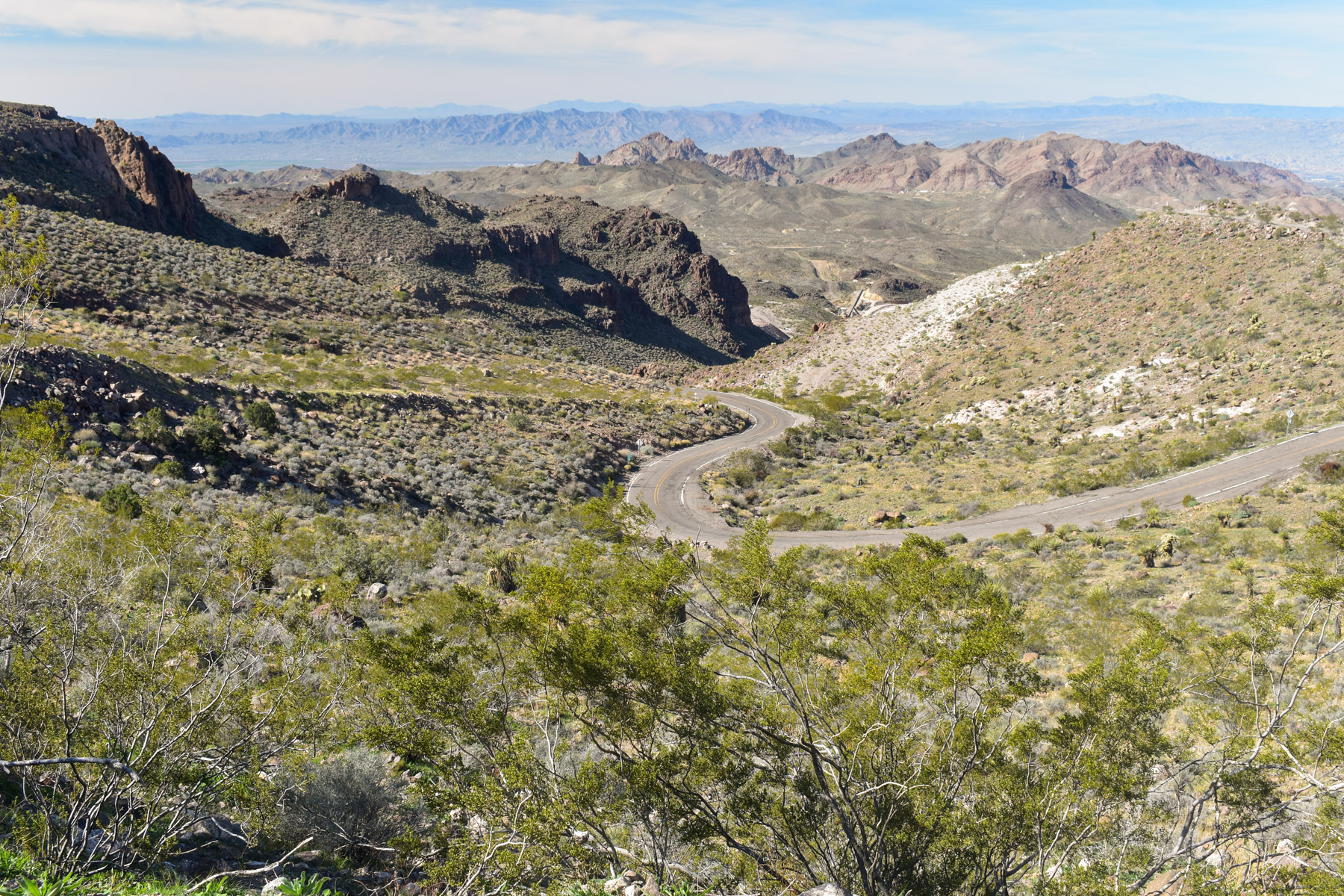
About this place
Route 66 was one of the first roads to cross America, joining Chicago to Los Angeles, and nearly 400 miles of it ran through Arizona.
It threaded the main streets of the towns and cities it passed.
This 42-mile stretch of two-lane blacktop is one of the last and best preserved pieces of the original road.
Almost any road-worthy vehicle can drive it, because it is paved asphalt. An automatic transmission is easier on the steep grades.
Wider vehicles, an RV among them, should take care.
The byway runs through public land and private, through wilderness, valleys and main streets. Respect all of it.
In the 1930s this piece of the highway held one of the things flatland drivers feared most.
Sitgreaves Pass carries Old Route 66 over the Black Mountains of western Arizona. Hairpin curves and steep grades are what the old road is remembered for.
The byway passes between the Mount Nutt Wilderness and the Warm Springs Wilderness. The Black Mountains are in view most of the way.
Mileposts 15, 17.1, 33.8 and 34.7 all give you a way into the Warm Springs Wilderness. There is walking, horse riding and camping away from any campground.
Every one of those access routes needs four-wheel drive.
Oatman is nearby, and so is the downtown Kingman Visitor Center.
You can drive it in any month. October through April is the best of it.
There is no drinking water anywhere along it, and no toilets. Carry plenty of water.
There is no public internet or Wi-Fi.
Looking after yourself is your job here. Call 911 for law enforcement, for emergency services or to report a fire. Nobody here can give you first aid.
Venomous reptiles and insects, extreme heat, extreme cold and flash floods are all possible along the route.
Watch the weather and keep up with any warnings. Tell somebody your plans and when you expect to be back.
Carry the right gear, food and water, and take tools, a shovel, a blanket, a jack and a spare tire.
Bring enough fuel. The nearest gas stations are in Kingman, Golden Valley, Bullhead City and Fort Mohave.
The signs and fences along the route are there to keep you safe.
The facts
- Cost
- Free to camp
- Roads around it
- Paved. An automatic transmission is easier on the steep grades
- Stay limit
- 14-day limit
- Drinking water
- No, bring your own
- Toilet
- No
- Type
- Open area. Camp anywhere within it
- When it’s open
- All year, though October to April is the best of it
- Managed by
- Bureau of Land Management
Rules and restrictions
- Nothing longer than 40 feet may go over Sitgreaves Pass, between Golden Valley and the ghost town of Oatman. Signs in Golden Valley remind you.
- Posted speed limits run from 20 to 45 miles per hour. Obey them, and every other traffic law.
- Keep pets on a leash at all times and pack out their waste. Service dogs may go anywhere a visitor can go.
- Every historic artifact along this road is protected by law. Leave them exactly as you found them.
- Fire restrictions change. Find out the current ones before you go.
- Exploding targets, fireworks, sky lanterns, tracer ammunition and anything else that starts a fire are prohibited on public land in Arizona.
- Leave no trace of your visit.
How long you can stay
You can camp on the land around the Route 66 Historic Back Country Byway, either out on your own or at a marked campground. Either way the limit is 14 days.
Work out before you go which land is public. Private and state land sits along this 42-mile stretch too.
Getting there
The Route 66 Historic Back Country Byway starts five miles south of Kingman, at the McConnico exit off Interstate 40. That is exit 44. To start at the southern end instead, leave Interstate 40 at the Topock/Golden Shores exit, exit 1. Switchbacks take you up to Oatman and the old mining settlement of Goldroad.
Coordinates 35.1391, -114.1077
Open in Google Maps Agency page
What is near here
A few more of our own spots are within reach of this one, along with some better-known places.
- Mount Nutt Wilderness Directions
- Hualapai Peak Directions
- Wabayuma Peak Wilderness Directions
- Boundary Cone Directions
- Davis Dam Directions
Every distance on this page is the driving distance. A short distance can still take a long time. The road may be closed for the season, covered in snow, or washed out. Many of these roads are dirt. Plan your route before you leave home. Out here there is often no phone signal to look it up on the way.
Nearest town and supplies
- Walnut Creek, AZ Directions
- Kingman, AZ Directions
Kingman is big enough that you’d normally expect fuel and somewhere to buy food. Nobody from here has been to check, so don’t count on it if you’re running low.
Have you been here?
Fees and access change, and the records do not always keep up. If you have been, tell us what you found.
Thank you, that is recorded. It helps the next person.
Add road notes for this site
The thing we cannot get from any government record is what the drive in is actually like. If you have done it, this is the most useful thing you can leave behind. We read everything before it appears, and we print a first name with it if you give one.
Thank you. A person will read it before it goes on the page.
Where this information comes from
The description on this page is ours. The facts in it, and the fee and facility details below it, come from the Bureau of Land Management’s own records, read in August 2026.