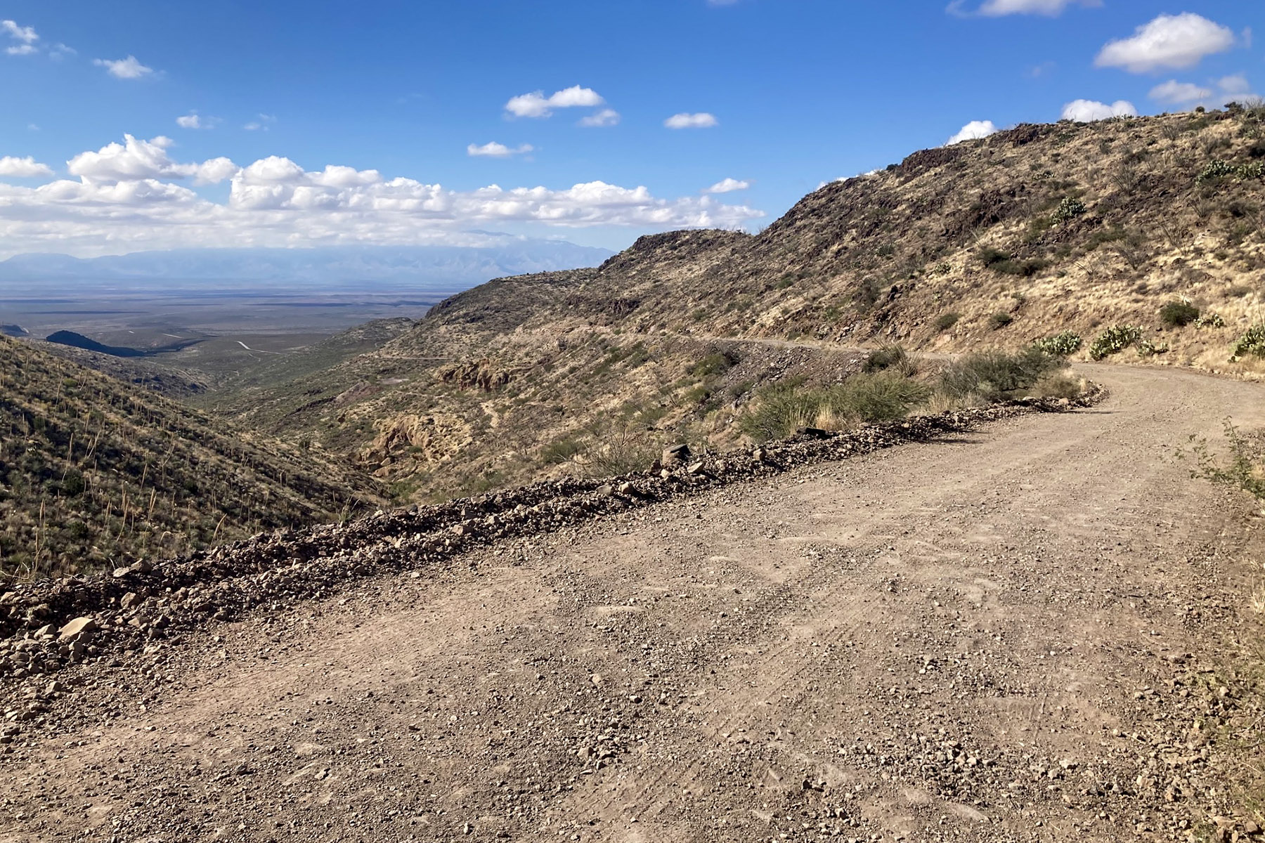
About this place
The Black Hills Back Country Byway runs 21 miles through hard, open country that was the Old West.
Pioneers cut their way through here. They lived close to the land, faced down what it threw at them, and left their mark on the American frontier.
You can follow the same ground today.
This is a Type II byway, built with high-clearance vehicles in mind. The road is unpaved, mostly native soil with stretches of gravel on top.
It is rough, but a two-wheel drive with high clearance will get down it. You do not need anything extreme.
The primitive side roads are another matter, and they suit off-highway vehicles and experienced mountain bikers.
There is history in the ground here. You can find what is left of old mining operations, and erosion control work the Civilian Conservation Corps did in the 1930s.
Rockhounds head for the Black Hills Rockhound Area nearby, to hunt fire agates. The rock formations along the route are unusual enough to be worth stopping for.
Walk a trail, wander cross-country or just pull over at the roadside. Either way you get sweeping views over the Gila Box Riparian National Conservation Area. There is a lot of wildlife about.
You may camp and picnic on public land along the road, and there are several developed sites.
Halfway along, the Canyon Overlook Picnic Area has shaded ramadas and barbecue grills, looking out over the Gila River canyon.
Near the east end is Owl Creek Campground, seven units perched on a cliff above the historic Old Safford Bridge.
The south end of that bridge is a popular launch for floating the Gila, and for catfish.
The north end has a small picnic area.
Mule deer, javelina and quail are among the animals you may hunt on public land along the byway.
It is open all year.
Some sections have narrow drop-offs and steep passages along the cliff, so take care. It is worse in wet weather.
Vehicles over 20 feet should not attempt this route, and that includes travel trailers and motorhomes.
There is parking near the kiosks at both ends of the byway for the bigger vehicles.
Drive as though there is another vehicle around the next bend. On a mountain road, traffic going uphill has the right of way.
The side routes are single lane and unmaintained, and you need four-wheel drive. They are steep and rocky, and a wash can hide the road altogether.
Navigation gets tricky out there. Go prepared.
There is no drinking water along the byway.
The only public toilets on the route are at the Gila River Boat Put In, near the northern end. Owl Creek Campground has a restroom, but that is for people paying to use the site.
Cell phone and internet reception is spotty, and it is worst in the mountainous sections.
You look after yourself out here. Call 911 for law enforcement, for emergency services or to report a fire. Nobody here can give you first aid.
Before you go, check the weather and the road conditions, and get hold of maps and route descriptions for this area.
Carry plenty of water and enough fuel. Take a spare tire and a jack, plus tools, a shovel and a blanket.
Watch for cattle on the road and beside it.
The facts
- Cost
- Free to camp
- Roads around it
- Unpaved. A high clearance two-wheel drive will do it
- Stay limit
- 14-day limit
- Drinking water
- No, bring your own
- Toilet
- Yes, at the Gila River boat put-in near the north end
- Phone signal
- Spotty, and worst in the mountain sections
- Type
- Open area. Camp anywhere within it
- When it’s open
- All year
- Managed by
- Bureau of Land Management
Rules and restrictions
- Service animals may go anywhere a visitor can go. Every other pet stays under your physical control at all times.
- The signs along the byway are not there for target practice.
How long you can stay
You can camp and picnic on the public land along this road, and there are several developed sites as well.
You get 14 days in any 28. After that you have to move at least 25 miles before you camp again.
Getting there
The Black Hills Back Country Byway runs between Safford and Clifton, in southeastern Arizona. That is about three hours northeast of Tucson, or 3 1/2 hours east of Phoenix. Both ends leave U.S. Highway 191: the southern end at milepost 139, the northern end at milepost 160.
Vehicles over 20 feet long should not attempt it, travel trailers and motorhomes included. There is parking near the kiosks at both ends for larger vehicles.
Drive carefully and expect another vehicle round every bend. On mountain roads, traffic coming uphill has right of way.
The side routes off the byway are single-lane and unmaintained, and they need four-wheel drive. They can be steep, rocky and rough, and washes can hide the road altogether. Ask the Safford Field Office how they are before you set off.
Coordinates 32.841624, -109.422658
Open in Google Maps Agency page
What is near here
A few more of our own spots are within reach of this one, along with some better-known places.
- Gila Box Riparian National Conservation Area Directions
- Mount Graham Directions
- Fishhooks Wilderness Directions
- Apache Pass Directions
- Steins Peak Directions
Every distance on this page is the driving distance. A short distance can still take a long time. The road may be closed for the season, covered in snow, or washed out. Many of these roads are dirt. Plan your route before you leave home. Out here there is often no phone signal to look it up on the way.
Nearest town and supplies
- San Jose, AZ Directions
- Clifton, AZ Directions
Clifton is big enough that you’d normally expect fuel and somewhere to buy food. Nobody from here has been to check, so don’t count on it if you’re running low.
Have you been here?
Fees and access change, and the records do not always keep up. If you have been, tell us what you found.
Thank you, that is recorded. It helps the next person.
Add road notes for this site
The thing we cannot get from any government record is what the drive in is actually like. If you have done it, this is the most useful thing you can leave behind. We read everything before it appears, and we print a first name with it if you give one.
Thank you. A person will read it before it goes on the page.
Where this information comes from
The description on this page is ours. The facts in it, and the fee and facility details below it, come from the Bureau of Land Management’s own records, read in August 2026.